 Projects
 CBLAST Hurricane Solo Float Deployment Page
2004 Frances Jeanne » All Floats
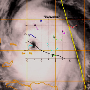
Above: Goes IR Image - 9/2/04 0045Z
CBLAST Solo Float Positions During Hurricane Frances
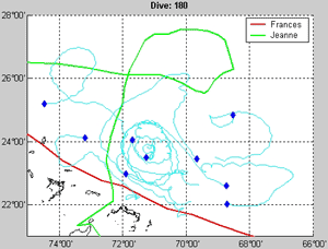
Above: Image still taken from a video rendering of
float trajectories. Click on the image to download
the video (5.1 MB). An alternative Quicktime
download is available as well (17.7 MB).
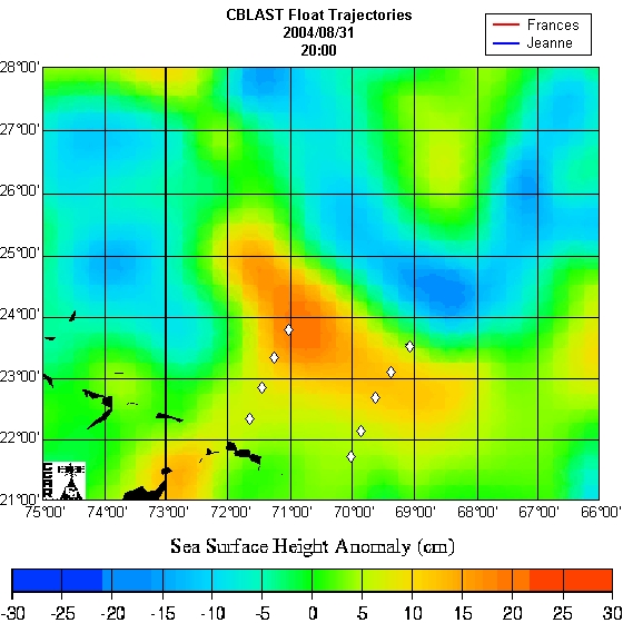
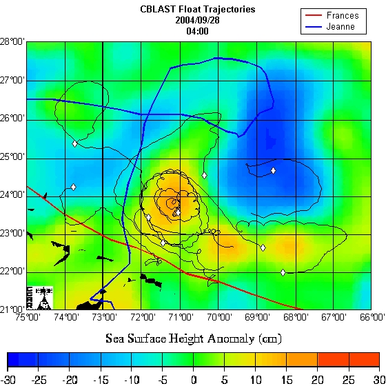
Above: Correspondence of sea surface height anomalies with float trajectories. The initial
deployment array is shown on the left and trajectories near the end of the experiment are
shown on the right. Blended altimetry obtained from Colorado Center for Astrodynamics
Research, Univ. Colorado, Boulder
http://e450.colorado.edu/realtime/gsfc_global-real-time_ssh
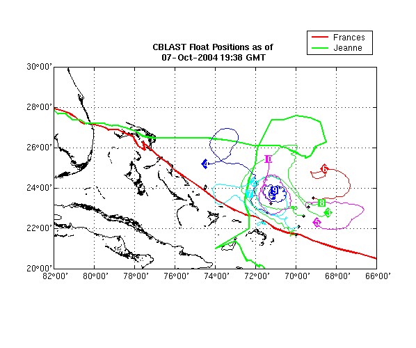
Above: All CBLAST Floats' Positions - Wide View
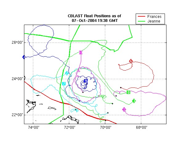
Above: All CBLAST Floats' Positions
Disclaimer: WARNING: These real-time ocean current measurements are experimental and have not undergone any error-checking or quality assurance efforts. While considerable effort has gone into ensuring the highest quality data, significant differences between measured currents and actual currents can occur. This information should not be used to make any navigational or other decisions that might endanger public safety or put anyone at significant risk. These are not official data products of the University of California. We reserve the right to ADD, CHANGE or DELETE any product WITHOUT PRIOR NOTICE.