 Projects
 OSPR
OSPR
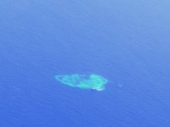
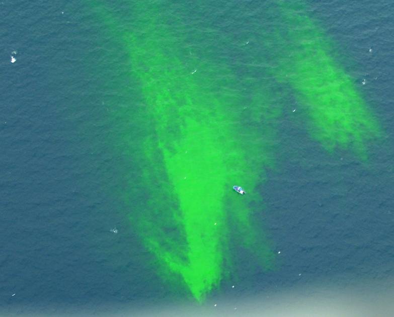
At-sea tracking of a simulated dispersed oil plume.


-
Assets:
-
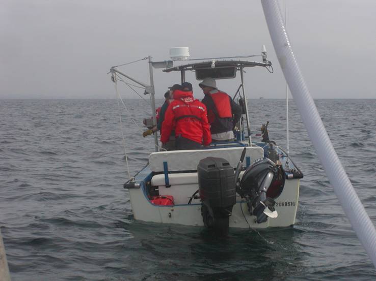
- Dye Dispersal vessel
- 32' oil spill response vessel operated by Marine Spill Response Corporation
-
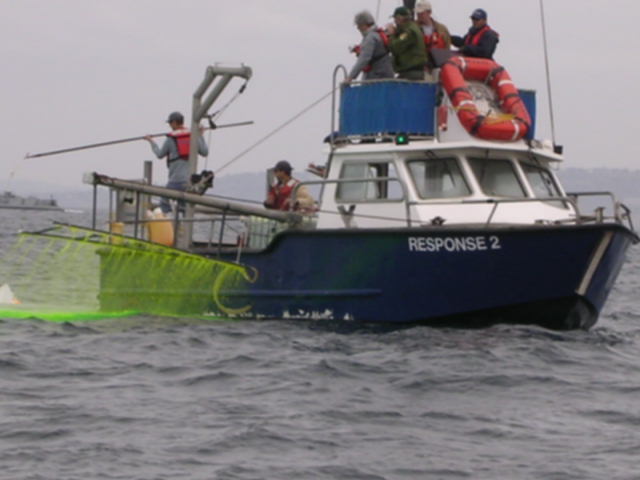
- Plume sampling vessel
- 22' research vesesl operated by Scripps
- Horizontal plume tracking using USCG SMART system operated by Strike Team
- Vertical plume tracking by Scripps scientiest using CTD + fluorometer
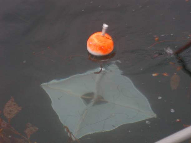
- GPS tracked drifter array operated by Scripps
-
Surface Current Maps created by HF RADAR
- Integrated Ocean Observatory
- 3 overflights in aircraft for aerial imaging
- SIMAP modeling of plume
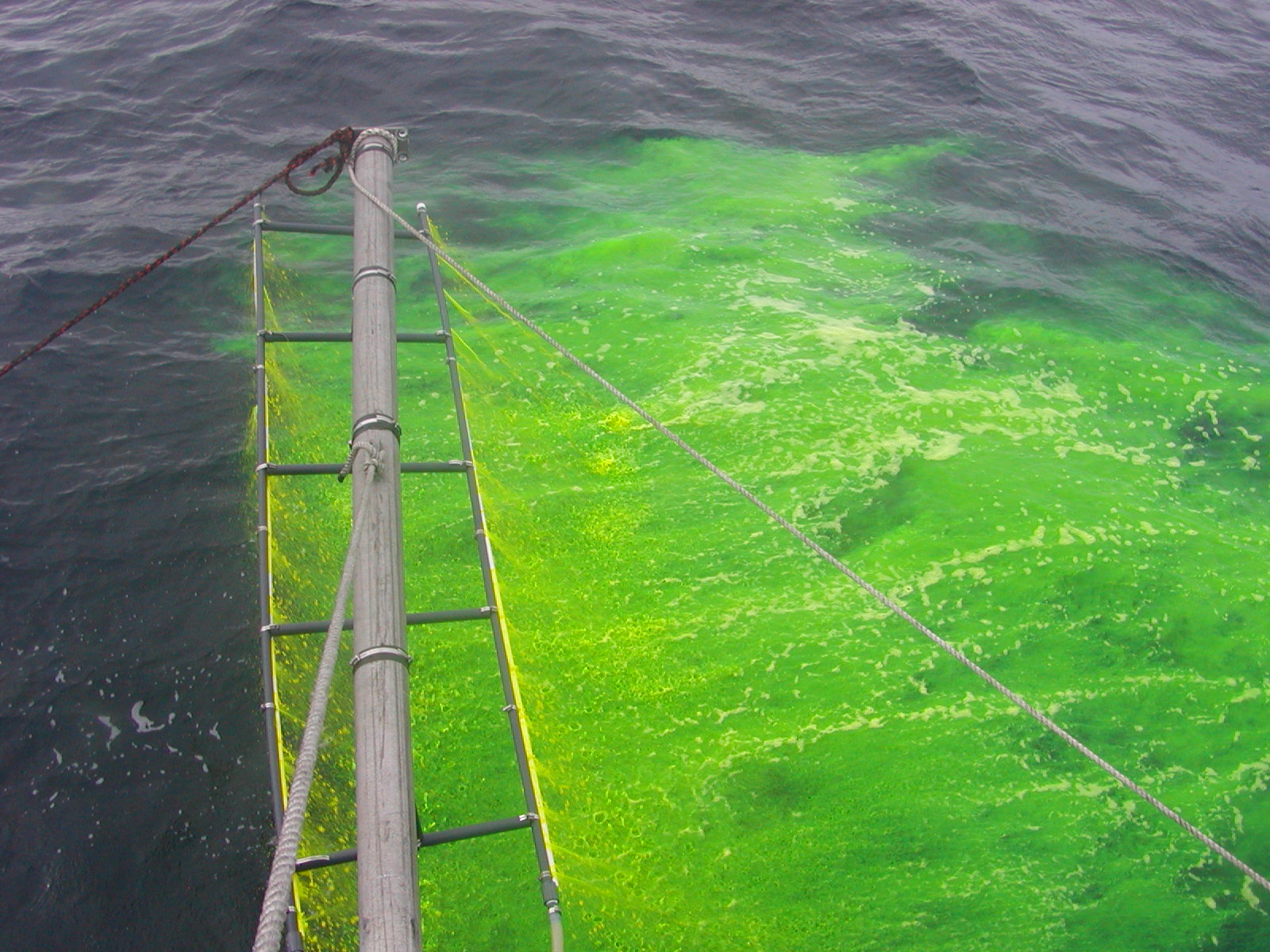
Plume dispersed as a function of time
In-plume sampling conducted by Scripps and USCG Strike Team with SMART system and CTD profiles
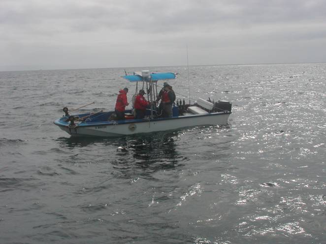
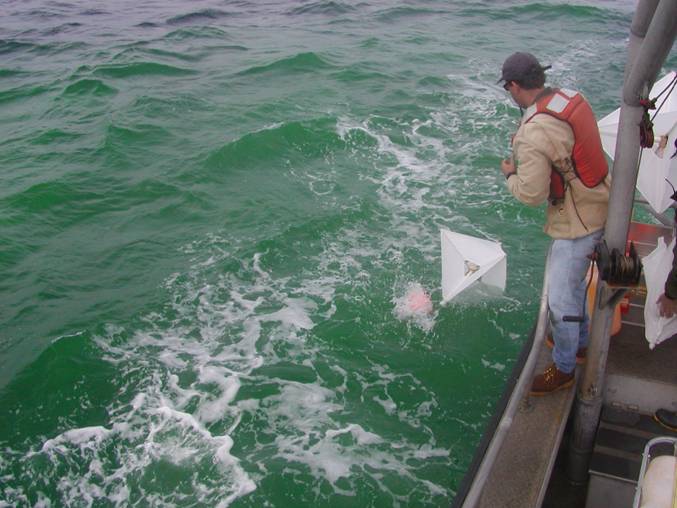
Dye deployment from dye release mechanism
Deployed GPS drifters at the initial edges of the plume
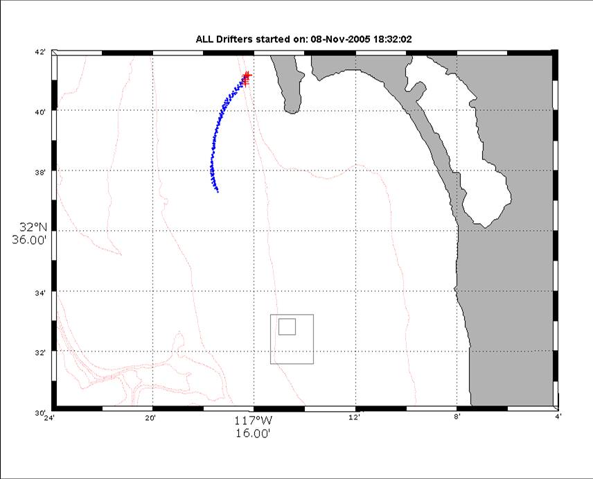
GPS drifter tracks during experiment
Surface Current mapping using HF radars operated in real-time during experiment
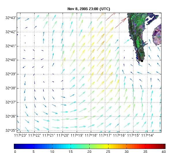
Trajectories of simulated plume computed using surface current maps from HF RADAR
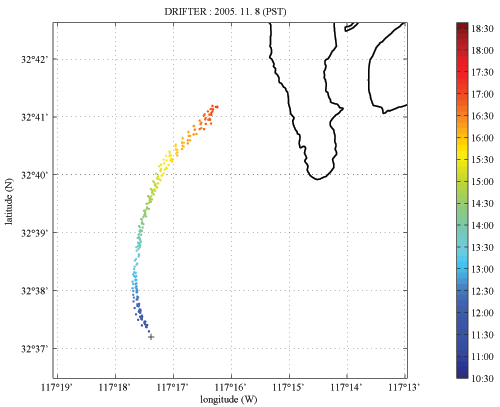
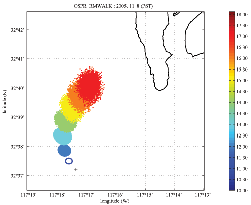

Good agreement found between plume dispersal and drifter tracks
Initial CTD data showing vertical dye dispersion.
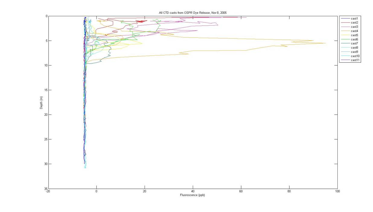
Nov. 8, 2005 field experiment. Casts were completed along orthogonal transects through the plume over a 2 hour period.
Additional refinements to dye plume tracking
- High resolution plume mapping with undulating tethered UV/Fluorometers
- Continuous data readout on board tracking vessel
- Deployment of multiple drogues at different depths (1,3,5, and 10m) to better track displacement of subsurface plume
Conclusions from 8 Nov. 2005 dye deployment
- Successfully completed one of two OSPR-supported cruises and will continue to build upon and improve operational success with additional efforts.
- Excellent agreement was obtained between CODAR and surface drifters (1m).
- Aircraft support and multi-spectral imaging allowed plume dimensions (advection and diffusion) to be tracked in the horizontal over time.
- CTD and in situ UV/Fluorescence data from orthogonal transects will allow plume delineation in vertical as well as horizontal dimensions.